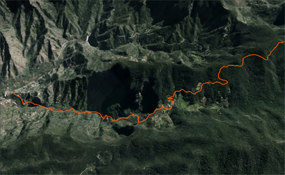
Sendero Montaña Quemada
This route is one of the most visited because its access is easy. The pathway is accessible by car from the GM 1 and the km. 14, we take a diversion (commonly known as the crossroads of “Cruce del Rejo”) that will take us towards the Garajonay National Park. After 6 km of route with ascension, we`ll find an access to our right, properly signposted, which will indicate the beginning of a paved forest path; here will start our journey on foot.
In general speaking the difficulty of this route is low, since the trail in its entirety goes downward from a height of 1080 meters in the beginning to 250 meters at the end of the path. The opening track has a strong pavement and the environment is more majestic and lush the more we enter it. We are immersed in a laurel forest where heathers alternate, bog myrtle, ferns and some other laurel, among other species.
After 1.5 kms we reach another deviation that indicates the direction to follow, to the right, towards the hamlet of El Cedro. Its a population area that had its splendor in the 20s, because of the strong commitment to traditional agriculture: exploiting forest resources, collecting and selling firewood, charcoal making, raising livestock and taking advantage of the healing properties of many plants. This spot was a landmark and important agricultural trade area for for a long time. Today the few families that live here have changed agriculture for tourism through renting rural houses and offering the taste of the typical gomerian récipes in restaurants of the area. In this village we can make a break before starting the steep descent, on the left bank of the ravine of El Cedro, following the bed of a stream, rushes into the ravine of Monteforte.
As we walk down a paved path in zig – zag we can see on our right to the fullest the spectacular waterfall of El Cedro, popularly known as “El Chorro”. The path may seem steep at the beginning, becomes softer as it descends, allowing the traveler to observe the different layers of vegetation that are distributed on the wall of the ravine. A beautiful contrast between the green vegetation and the crystal clear waters that continuously poured into the dam of Los Tiles.
On the right side of the ravine there are traces of a hydraulic engineering which time ago supplied electricity to the hermiguan population.
We are already at the dam of Los Tiles and continue the path down passing cement stairs that follow the course of the ravine through a narrow road running through farmland. In this area we can see that, alongside various ponds, there are remains of old water mills that grounded the grain of much of the island.Entering a garden area we continue along a waterway. We leave it on the right side at a small cross next to a mark on a rock and go a paved road downwards that will lead us to the road of Lomo San Pedro and the basis of the Roques de Hermigua unique structure (Geological python) of great beauty, which currently is equipped to practice climbing.
Following this road, always downhill, we can see on the left some details of Hermigua and can spot, for example, the Church, the Convent of Santo Domingo and Los Telares, a must see, for its meaning in heritage, culture and craft. Continuing along this road we reach the crossing of Hermigua, GM-1, where the end of the road is located.

